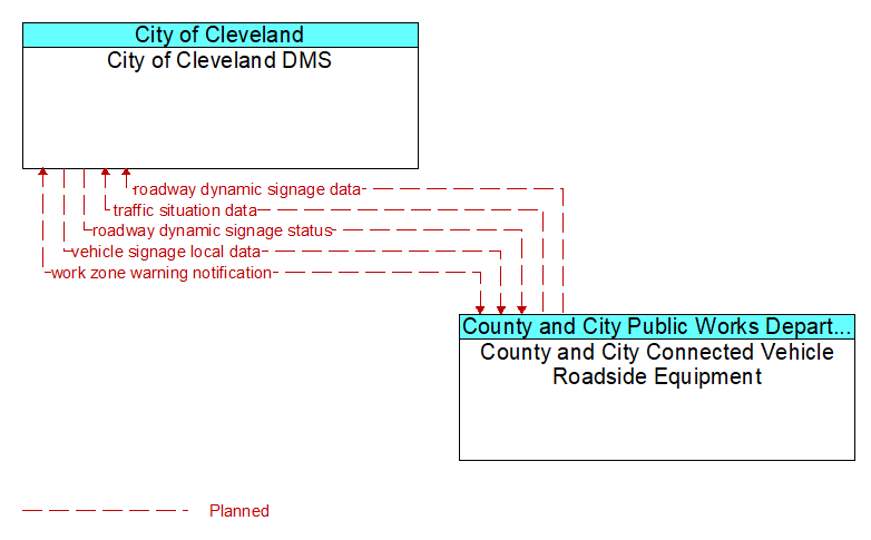
Interface: City of Cleveland DMS - County and City Connected Vehicle Roadside Equipment
Architecture Flow Definitions
roadway dynamic signage data (Planned) Applicable ITS Standards
Information used to initialize, configure, and control dynamic message signs. This flow can provide message content and delivery attributes, local message store maintenance requests, control mode commands, status queries, and all other commands and associated parameters that support remote management of these systems.
roadway dynamic signage status (Planned) Applicable ITS Standards
Current operating status of dynamic message signs, highway advisory radios, or other configurable field equipment that provides dynamic information to the driver.
traffic situation data (Planned) Applicable ITS Standards
Current, aggregate traffic data collected from connected vehicles that can be used to supplement or replace information collected by roadside traffic detectors. It includes raw and/or processed reported vehicle speeds, counts, and other derived measures. Raw and/or filtered vehicle control events may also be included to support incident detection.
vehicle signage local data (Planned) Applicable ITS Standards
Information provided by adjacent field equipment to support in–vehicle signing of dynamic information that is currently being displayed to passing drivers. This includes the dynamic information (e.g., current signal states, grade crossing information, local traffic and road conditions, detours, advisories, parking availability, etc.) and control parameters that identify the desired timing, duration, and priority of the signage data.
work zone warning notification (Planned) Applicable ITS Standards
Notification of a work zone emergency or safety issue. This flow identifies that a work zone emergency or safety issue has occurred so that warnings may be generated by more than one system in the work zone.